- Start
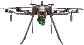
- Hybrid drone platform
- Ground Control Station

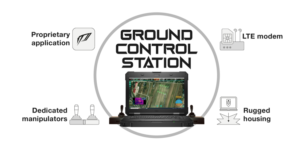
Ground Control Station
with proprietary Pilot Control Cockpit (PCC) application for flight control and data transmission

Flight control
and payload
and payload
Ability to control the flight and payload attached to the HPD using dedicated manipulators
Control by
pointing devices
pointing devices
Ability to control flight in automated modes using pointing devices (keyboard, mouse, touchscreen).
Automated
manoeuvres
manoeuvres
Thanks to its ability to react instantly to changing environmental conditions (e.g. strong gusts of wind), the on-board computer will perform manoeuvres efficiently on the basis of pre-set parameters (target take-off height or landing point).
Video stream
from on-board camera
from on-board camera
Receiving video streams from the drone’s onboard cameras and controlling the observation head.
Receipt of data
from payload
from payload
Support for plug-ins to receive, process and visualise real-time data from H2 accessories.
LTE
connectivity
connectivity
Ability to connect to the H2 from anywhere in the world, thanks to mobile connectivity. Constant access to the internet (downloading terrain maps and other data). Live video reception from the H2.
Ruggedised computer
for tough environments
for tough environments
MIL-STD-810G4 compliance: drop during transport (36″/0.91 m), single unit, 26 drops, drop during operation (36″/0.91 m), wind dust, vibration, physical shock, humidity, altitude, temperature extremes.
Support of a ground-based
GPS-RTK station
GPS-RTK station
Ability to support a GPS-RTK ground station connected to the GCS increasing the accuracy of HPD positioning in space.
The ability to conveniently and efficiently design both simple and advanced automated missions:
- carrying out point-to-point flights,
- carrying out patrol and inspection flights,
- carrying out photogrammetric raids of defined areas,
- automatically adjusting flight parameters to easily definable sensors that can form the HPD payload,
- which can be designed before flight by the commissioning party and imported into the drone’s memory just before flight by the operator,
- which can include definitions of multiple points representing points of emergency return in the event of loss of communication (RTL function),
- may include definitions of no-fly or no-fly zones (geofences).
Clear visualisation of key flight-navigation parameters by:
- artificial horizon,
- an interactive map with markings of the HPD position and all elements of the planned mission,
- the application of parameters to the video stream transmitted by the HPD in the form of OSD (on screen display) indicators,
- interactive indicators.
Monitoring of HPD performance
Active monitoring of HPD operating parameters to control the status of the power system (e.g. combustion and generator output, fuel quantity), the status of the propulsion system (e.g. frame vibration, engine temperature), the status of on-board systems and avionics (e.g. LTE signal quality, GNSS satellite visibility, parachute status)and alerting the user in the event of anomalies that may affect safety or operational performance.


Follow us
Contact
-
+48 797 476 054
-
Al.Krakowska 110/114
budynek B-27
02-256 Warszawa


