- Start
- Critical infrastructure
- Transmission networks
Solutions for transmission networks
Using 3D maps, aerial LiDAR point clouds, images/recordings or gas sensor readings, workers in this sector can get a detailed picture of key elements of the transmission network while optimising resources and maintaining safety.
Key benefits
for transmission networks
General inspection
Ongoing aerial overview of the condition of the pipeline and regular monitoring of potential risks to identify problems early and address them in a timely manner.
- Staff may be exposed to security risks when inspecting and maintaining pipelines located in remote areas, while monitoring vandalism and theft is difficult.
- Failure to detect illegal construction and occupation in time could pose a risk or cause damage to oil and gas pipelines.
- As the pipeline ages, the risk of failure and leakage increases, the frequency of inspections needs to be increased and a large workforce is required.
Drones improve general inspections
- The drones are flexibly deployed to quickly get an overview of the pipeline network while capturing details.
- Digitisation of inspection results through the use of drones to obtain live views of pipeline networks to collect evidence of illegal activities and preserve footage for record keeping and condition comparison.
- Supplementing a traditional inspection with drone imagery improves productivity while protecting workers from unsafe environments.
Leak detection and repair (LDAR)
(Leak Detection and Repair)
Fast and accurate detection of leaks using drones equipped with specialised sensors, ensuring staff safety and enabling timely decision-making.
- Leaks threaten the safety of the facility and local communities.
- The location of the spill can be difficult to determine, not to mention obtaining a reading of the spill concentration.
- On-site personnel cannot quickly visualise the scale of a spill or predict its development without insight.
Drones help detect and repair leaks
- Drones equipped with gas detectors can quickly scan large areas and pinpoint the location of a leak so that it can be dealt with immediately.
- Drones can help staff determine the extent of a spill, while sending aerial information to help monitor repairs on site.
Responding
to crisis situations
Flying over the affected areas, documenting the damage to infrastructure and property and creating accurate models to help optimise recovery efforts.
- Emergency repairs require timely coordination between on-site and off-site teams, which can be difficult to manage alone.
- Repairs involving ‘hot’ work must be closely monitored to ensure safety and compliance with regulations.
- Repairs may not take place simultaneously at multiple locations on the site, and if they do it can be difficult to monitor.
Drones improve crisis response
- Deploying drones to quickly map the site of an accident can provide key information on the scale of the accident so teams can establish a plan of action.
- Monitor from the air the site where work is being carried out ‘hot’, sending live video to the command centre to quickly coordinate the tasks of the teams.
Mission situational awareness
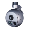
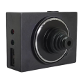
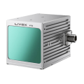
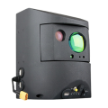
Provide those overseeing the operation with an accurate, real-time view of the mission, enabling confident decision-making. Use our Prometheus H2 Hybrid Drone Platform, equipped with professional cameras, thermal sensors, LIDAR or a methane detector to respond more effectively in crisis situations, helping mission leaders to take the initiative quickly through better situational awareness.
- Without comprehensive mission data, ground teams struggle with blind spots and are exposed to unnecessary risks.
- Insufficient situational awareness hinders the effective allocation of resources to maximise safety and minimise response time.
Drones increase mission situational awareness
- The drone allows you to get to the scene quickly and gain immediate aerial insight.
- Hovering over the unfolding mission and sent live updates directly to surveillance centres.
- Synchronisation of teams, elimination of uncertainty and certainty in decision-making.
Maintaining a safe distance
Aerial imaging with the Prometheus H2 HPD, together with dedicated accessories, can help identify the location of a fault or leak and then assess the level of risk when the fault site needs to be scanned from a distance for safety reasons.
During an operation, there is a lot of critical information that can be combined using images and data from a drone. For example, determining the presence of civilians in an area, the exact location of an incident site and even spotting a route of efficient access.
Such insights enhance the effectiveness of the transmission network maintenance teams’ plans and actions.
Dedicated accessories for Protector, Inspector and Enterprise models


Follow us
Contact
-
+48 797 476 054
-
Al.Krakowska 110/114
budynek B-27
02-256 Warszawa


