- Start
- Critical infrastructure
- Energetics
Solutions for
the energetic industry
Using photogrammetric maps or aerial LiDAR point clouds, workers in this sector can get a detailed picture of key elements of the power grids while optimising resources and maintaining safety.
Key benefits for the energetic industry
Vegetation management in the surroundings of the energy network
Quickly map power line corridors, creating accurate 2D and 3D models that measure the distance between vegetation and power lines, helping to maintain a safe distance from the lines.
- Traditional methods using manned aircraft are expensive and require specific locations for safe take-offs and landings.
- To maintain a safe flight altitude, manned aircraft cannot track the terrain accurately, so it is difficult to accurately model corridors in mountainous areas.
- Obtaining the final model can take several days, from flight path planning, execution, data export and processing.
Drones help with vegetation management
- Drones can be flexibly launched in remote areas at a lower cost than manned aircraft.
- Drones can operate in complex terrain and their intelligent features follow the terrain to ensure safe flight without losing data accuracy. 3D models can be created in real time for projects that have a tight deadline.
Asset integrity management
Conduct frequent on-demand inspections to monitor the safety, reliability and integrity of the power network, improving efficiency and eliminating risk.
- Power networks often extend over long distances, which can be difficult to access and manual inspections can be time-consuming.
- Defects associated with hazards high up on assets can be overlooked when observing only from the ground.
Drones help manage asset integrity
- Drones can take off in minutes, covering large areas during each flight, effectively providing useful information.
- Drones help identify threats to asset integrity and inform response actions, providing close-up data as well as comprehensive overviews.
Detailed inspection
Get standardised data from automated drone inspections that accurately identify failures.
- Inspection staff must examine and screen all elements of the pylon, which is demanding for the teams.
- Traditional inspections are unable to produce structured, standardised data that can be used to automatically detect defects.
Drones carry out detailed inspections
- Automated flight paths can be set up to inspect high-altitude objects, creating detailed 3D point clouds without risking the safety of human operators.
- The drones are easy to use, enabling inspection teams to obtain high-quality data with basic training, while standardising output and streamlining processes.
- Inspection processes are closed, ensuring data integrity
Thermal inspection
Obtaining real-time readings of resource temperatures using drones equipped with radiometric thermal sensors to immediately identify anomalies.
- Thermal inspection equipment on the ground may not give an insight into the condition of tall structures.
- Thermal inspections with helicopters are too costly to be carried out on a mass scale and the long preparation time slows down rescue operations.
Drones can perform a detailed thermal inspection
- Drones can capture a subject from multiple angles, ensuring that key details are not missed.
- Drones take off within minutes and are not restricted by strict configuration requirements, allowing for rapid response.
- Inspection teams can get visual and real-time temperature readings on all parts of the asset to quickly identify and address problems.
Damage inspection
Capture the condition of assets from multiple angles using drones to reveal any faults or defects and address them in a timely manner.
- Serious defects often need to be repaired immediately, and manual inspections can cause repair delays that lead to losses.
- Inspection staff must manually search for defects and may be limited by the availability of assets and available tools.
Drones carry out damage inspections
- Drones provide an aerial perspective that captures critical information regardless of the environment, enabling inspection teams to act quickly and minimise damage.
- Drones take off within minutes and are not restricted by strict set-up requirements, allowing teams to pinpoint any faults.
Night-time inspection
Perform inspections in low-light conditions or at night with a drone equipped with a night vision camera.
- Inspections often cannot take place in low-visibility conditions and staff may be at greater risk during night-time inspections.
Drones perform inspections at night or in low light conditions
- Drones equipped with thermal or night vision sensors and can identify threats even in low-light or night-time conditions.
Mission situational awareness
It provides operations commanders with an accurate, real-time view of the mission, enabling them to make confident decisions. Utilise our Prometheus H2 Hybrid Drone Platform, equipped with professional cameras, thermal sensors and night vision to respond more effectively in crisis situations, helping technical teams take the lead through better situational awareness.
- Without a comprehensive mission data, ground teams struggle with blind spots and are exposed to unnecessary risks.
- Insufficient situational awareness makes it difficult to allocate resources effectively to maximise safety and minimise response time.
Drones increase mission situational awareness
- Drone allows you to get to the scene quickly and gain immediate aerial overview.
- Hovering over the unfolding mission and sent live updates directly to the command centres.
- Synchronisation of teams, elimination of uncertainty and certainty in decision-making.
Keeping a safe distance
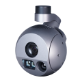
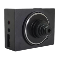
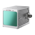
Aerial imaging with the Prometheus H2 HPD, together with dedicated accessories, can help identify the location of a damaged asset and then assess the level of risk when the site of the problem needs to be scanned from a distance for safety reasons or difficult environments.
During operations, there is a lot of critical information that can be combined using imagery and drone data. For example, determining the level of vegetation interfering with energy resources in an area, the exact location of the collision and whether an immediate response from grid maintenance services is required.
Such information enhances the operational effectiveness of the technical units and other teams working together.
Dedicated accessories
for Inspector
and Enterprise models
for critical infrastructure


Follow us
Contact
-
+48 797 476 054
-
Al.Krakowska 110/114
budynek B-27
02-256 Warszawa


