- Start
- Precision agriculture and forestry
- Forestry
Solutions for forestry
Our drone solutions can be used for rapid mapping and other forestry surveys.
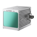
By using 3D maps or aerial LiDAR point clouds, the Forest Service can obtain a detailed picture of key and significant forest areas, while optimising resources and maintaining the safety of its staff.
By using 3D maps or aerial LiDAR point clouds, the Forest Service can obtain a detailed picture of key and significant forest areas, while optimising resources and maintaining the safety of its staff.
Key benefits for forestry
Another of the areas where drones play a key role in resource management and work organisation is forest management.
Drones provide many benefits, such as the ability to quickly cover large areas and capture high-resolution images and video for use in forest management.
Drones can be used for a variety of tasks including mapping and surveying, monitoring forest health, assisting in fire fighting and surveillance to prevent illegal logging and other criminal activities.
They can also be used to observe and track wildlife and to assist in search and rescue operations. The use of drones in forest management is still developing, but the results are promising and applications will increase as the technology becomes more advanced and accessible.
Faster data capture and cost reduction
Drones are very flexible when it comes to being ready to fly, which gives them a distinct advantage over traditional aerial data collection methods. They can be easily deployed and acquire data much faster than manned aircraft, helicopters or satellites, without compromising data accuracy.
Drones can help reduce the time and costs associated with conducting forest surveys and managing forest resources. They can also help identify areas that need attention and can provide real-time information on the health of trees and any other vegetation. Early identification of any tree health problems gives forestry professionals more time to plan action and rectify the situation.
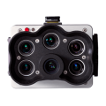
Whether it’s finding pest disease, identifying soil contamination, tracking a fire or monitoring any illegal activity, a drone can be equipped with multispectral or thermal imaging cameras to more easily identify these problems without the cost of hiring an aircraft or helicopter.
Increased safety
Forests can be difficult to navigate on foot, the terrain is uneven, difficult to access and can be dangerous and, in the event of a forest fire or other disaster, downright dangerous and therefore even more dangerous to survey and collect data on the ground.
Drones provide a much safer way to collect data from the air, carry out surveillance missions and conduct search and rescue operations in forests and wooded areas.
Because drones are easier to pilot, they can be deployed very quickly and pre-programmed autonomous missions can be carried out more regularly without putting forestry workers at risk.
Increased flexibility
Drones offer greater flexibility when it comes to planning activities, as well as the ability to move freely around an area. This makes them easier to use than traditional vehicles for the day-to-day management of forest resources.
Decreased fuel consumption
Another benefit of using drones is their low fuel consumption, this not only helps in the fight against climate change, but also reduces the need for small, manned aircraft, which are very expensive to operate and use a lot of aviation fuel.Geospatial data and mapping
Drones are now being used in forestry to help manage forests and monitor tree health. They are also used to map landscapes, measure forest density and collect data on tree characteristics.
One of the main reasons why drones are such a good tool for forestry is that they allow precision and accuracy when it comes to spatial data. This is because drones can fly very low to the ground and take high-resolution photos and videos, which are ideal for mapping purposes.
Drones are also effective in collecting data on tree characteristics such as height, diameter, age and location. This is useful information for monitoring the health of the forest and making informed decisions about how to manage it.
Fighting fires and other hazards
Drones are also being used to help fight forest fires, they can be used to collect data on the spread of the fire, its intensity, where to allocate more resources and to find people. Drones are also used to carry out controlled burns to reduce the impact of forest fires and stop their spread.
Prevention of theft and other crimes
Drones can also be used for surveillance and security purposes, being used to monitor illegal activities such as illegal logging and locating criminals or lost people.
Another emerging application of drones in forestry and agriculture is seed planting, drones are being used to counter the effects of deforestation by planting seeds at a much faster rate than can be done manually. This will help reduce the effects of climate change and allow forestry professionals to reforest much faster and on a larger scale.
Another emerging application of drones in forestry and agriculture is seed planting, drones are being used to counter the effects of deforestation by planting seeds at a much faster rate than can be done manually. This will help reduce the effects of climate change and allow forestry professionals to reforest much faster and on a larger scale.
H2 drone dedicated to forestry sector
Professional drones such as the Prometheus H2 – are more robustly built, allowing them to operate in harsh weather conditions. They also have a much longer range and flight time, which has obvious advantages such as covering more terrain including for line-of-sight (BVLOS) operations.
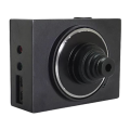
Drones offered by Prometheus can be equipped with a high-resolution RGB camera or a thermal imaging camera. A thermal imaging camera for forestry is very important, particularly for identifying any problems with the health of trees and other forest flora, as well as for locating hot spots in the case of forest fires and locating missing persons in search and rescue operations.
Drones offered by Prometheus can be equipped with a high-resolution RGB camera or a thermal imaging camera. A thermal imaging camera for forestry is very important, particularly for identifying any problems with the health of trees and other forest flora, as well as for locating hot spots in the case of forest fires and locating missing persons in search and rescue operations.
Hybrid drone platform 
Dedicated accessories for Inspector
and Enterprise models
Similar solutions


Follow us
Contact
-
+48 797 476 054
-
Al.Krakowska 110/114
budynek B-27
02-256 Warszawa


