- Start
- Precision agriculture and forestry
- Precision agriculture
Solutions for precision agriculture
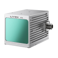
Using 3D mapping, photogrammetric imagery, multispectral imagery or aerial LiDAR point clouds, workers in this sector can obtain detailed images of key significant agricultural areas while optimising resources and maintaining safety.
Key benefits for precision agriculture
What is precision agriculture
Precision agriculture is a methodology based on working more accurately and efficiently on individual sections of larger fields. Using precise data, farmers can develop a more efficient way of sowing and watering crops, as well as applying fertilisers, pesticides and other sensitive chemicals.
Old methods
- The old methods of applying fertilisers and pesticides were not precise enough to deal with the conditions of part of a field – treatments were applied based on the average characteristics of the whole area, which could be inaccurate and uneconomical.
How drones are supporting precision agriculture
- Now, with the ability to record more precise measurements on a site-by-site basis – including from drone-mounted sensors – this has helped usher in a new era of smart farming. Now farmers can carry out precision spraying based on accurate data, their yields and production can increase, while wastage decreases.
- Precision farming can be compared to a more classical form of cultivation and farm management before mechanised farming came along. Back then, farmers could divide fields carefully and treat each segment accordingly. Precision agriculture combined this level of specialisation with modern data processing and automation and the resulting improvements in agricultural crop yields.
Applications of drones
There are many use cases for drones in precision agriculture, especially when considering that UAVs can fulfil multiple roles simultaneously. From more frequent and accurate aerial mapping to planning precision chemical spraying, the agricultural drone is an ideal tool for building efficiency in precision agriculture.
Drone versus satellite
- Satellite imagery, no matter how advanced a camera is, still comes from orbit. A drone flying over the field provides a much closer proximity and therefore a higher resolution of the image. In addition, when a farmer uses satellite imagery, it can be several days old. The drone can provide more up-to-date information, allowing for even greater precision in the fertilisers and pesticides needed.
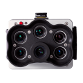
- When equipped with advanced sensors, drones can provide multispectral imaging, giving users more detail on how individual crops are performing. These cameras capture more information than standard cameras, including in the near-infrared band. Using light that is invisible to the eye, these cameras can help farmers create more accurate drought maps and really give crops the attention they need.
- Multispectral maps are not the only type of aerial imagery that is better when taken by a drone. Standard maps taken in red-green-blue (RGB) format can show farmers how crop growth is progressing. For the purposes of precision agriculture, it pays to have these images taken by drones rather than satellites. The much higher resolution per pixel gives a more accurate, detailed picture of crop condition, allowing for more personalised precision farming strategies.
Which drones should farmers look for
Recent years have brought a major shift in precision agriculture technology and new drone models and payloads of additional accessories have been designed with specific agricultural use cases in mind. Below are just a few of the equipment configurations that can bring the future of precision farming into the present.
- Drones for multispectral imaging: Using a drone such as the Prometheus H2 with a multispectral camera allows farmers to get a precise aerial view, one that goes beyond the visible spectrum. This drone captures standard RGB images and the Normalized Difference Vegetation Index (NDVI) at the same time, providing specific information about given areas of the field. The camera provides centimetre accuracy and the drone can be programmed and positioned even in areas without radio network coverage using LTE mobile networks.
- GPS software kits: While it is natural to think about hardware and accessories when designing a drone-based precision farming strategy, there is a less glamorous but equally important side to these operations: software tools that organise data and help farmers put it to use. For example, a geographic information system (GIS) such as Prometheus mapping software hosted in the cloud can create accurate 2D and 3D models of fields. When overlaid with the NDVI vegetation index, farmers can create prescription maps for other automated operations such as spraying.
- Task management software platforms: Using reliable task management and equipment management systems is essential for drone operators engaging in precision agriculture. By using a software platform designed for agriculture, farmers can immediately get more value from their drone operations by using workflows designed with their needs in mind, rather than having to customise functionality. Equipment management is not only the cornerstone of today’s precision agriculture, but also a pillar of the more automated operations that will emerge as more drone operators gain BVLOS capability.
The Prometheus H2 Hybrid Drone Platform, together with its proprietary flight control and data transmission software, the Pilot Control Cockpit (PCC), can perfectly fulfil these requirements.
The future of drones as precision agriculture technology
As drones become more common on farms, they can take on a number of tasks to help farmers optimise the way they manage their crops and more. Before sowing or planting even begins, farmers can generate 3D contour maps via GIS, allowing them to place crops more strategically. Flying with an imaging drone can help a farmer create yield estimates for insurance purposes, while assessing irrigation and soil moisture status in each part of the field.
Farmers with grazing animals can even track the position of their herds using surveillance cameras installed on drones. By finding more uses for drones around the property, these owners can quickly recoup their investment in precision farming technology. Whether a farm focuses on a single crop or is diverse in its operations, drones are and will continue to be a useful part of the new approach to farming.
The past few years have seen rapid development of practical drone functions and accessories that have the potential to revolutionise precision farming. Further regulatory advances and more widespread adoption of new technologies, including drones, will bring efficiency and value to more and more farms and the transformation has already begun.
Dedicated accessories for Protector, Inspector and Enterprise models


Follow us
Contact
-
+48 797 476 054
-
Al.Krakowska 110/114
budynek B-27
02-256 Warszawa
Śledź nas na
Kontakt
-
+48 722 058 057
-
Al.Krakowska 110/114
budynek B-27
02-256 Warszawa


