Start
Industries
Critical infrastructure
Engineering
Security
Rescue
Precision agriculture and forestry
Mining
Hybrid drone platform
Drone H2
Ground Control Station
Customer portal
Accessories for H2
Training partners
Technological partners
Distributors
Company
Industries
Critical infrastructure
Energetics
Transmission networks
Telecommunications
Railways
Roads
Precision agriculture
& forestry
Precision agriculture
Forestry
Engineering
Geodesy
Construction
Environmental protection
Rescue
Civil defence
Fire department
Water rescue
Mountain rescue
Security
Police
Border Guard
Territorial Defence Forces
Army
Mining
Mines
Quarries
Platform
Drone
Accesories
Ground Control Station
Customer portal
Company
Latest news
Hybrid drone platform
Dron
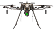
H2 drone – a hexacopter with a unique hybrid drive (combustion generator + battery) that can stay in the air for up to 5 hours and provides a flight range of up to 200 km.
Ground
Control Station
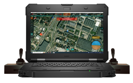
Ground Control Station with proprietary Pilot Control Cockpit (PCC) application for flight control and data transmission
Customer portal
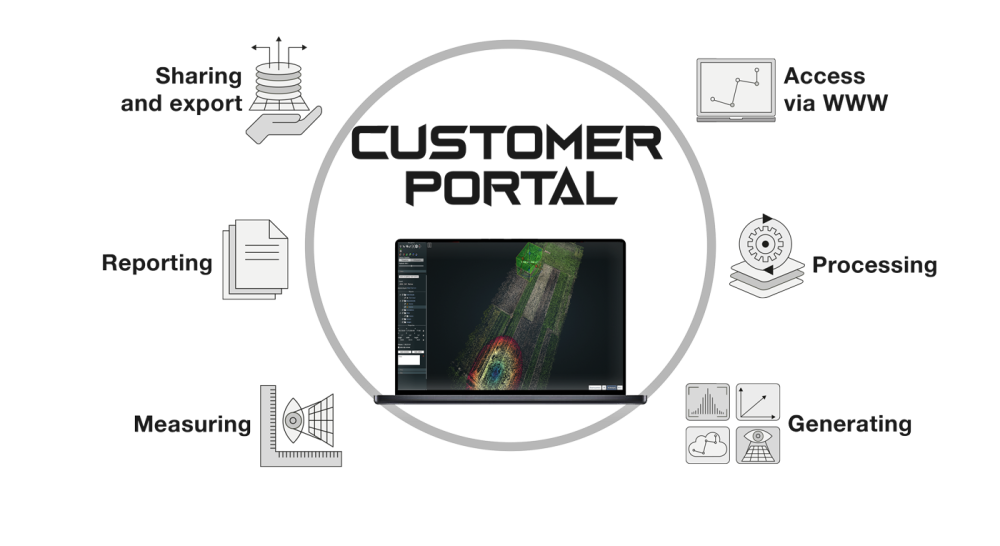
User-intuitive, professional software for processing digital images acquired from the Prometheus drone. It allows the generation of maps, point clouds, elevation models and textured 3D models from georeferenced images.
Drone
Key parameters
Transponder
ADS-B
MTOM
Maximum
take-off mass
Weight
without
fuel
Tank
for
fuel
Speed
vertical/horizontal
in km/h
Navigation
GPS, GLONASS
BEIDOU i GALILEO
Communication
Coverage
LTE networks
EU regulations
UE 2019/945
UE 2019/947
Dual modem
2 SIM
cards
Video Transmission
maks. Full HD
(optional – encryption)
Security
parachute
LIDAR, RTH
Dimensions
2,2m x 2,2m
x 1,1m
Ingress protection
Norm
IPX4
Wind resistance
Below
15m/sec
Temperature
Optimum operation
from 0 to 45C
Read more
Ground Control Station
Ground Control Station with proprietary Pilot Control Cockpit (PCC) application
for flight control and data transmission
Featured functions of the GCS
Proprietary application
Pilot
Control Cockpit
LTE
connectivity
freedom
of location
Dedicated manipulators
ergonomic
controls
Automation
of manoeuvres
automatic
take-off and landing
Visualisation
of location
in real
time
Monitoring
of parameters
security
alerts
Viewing
video
from multiple cameras simultaneously
Multi-screen support
separated
video view
Video
recording
on disk
of GCS
Planning
missions
automated
flyovers
Map
layers
specialised
maps
Plug-ins
for accessories
visualisation
live data
GPS-RTK
support
corrections
of position
Durability
of equipment
MIL-STD
810G
Read more
Customer portal
Access to the service via a web browser,
Processing of images acquired from photogrammetric flights,
Generation of: orthophotos, numeric terrain cover, point cloud, 3D model,
Basic 2D and 3D measurements,
Online data sharing,
Data export in geoTIFF, LAZ, GeoJSON, CSV and PDF formats.
Read more
Accessories for
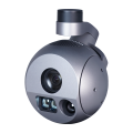
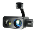
Gimbal with RGB sensor, x30 zoom
& thermal imaging
Gimbal with RGB sensor, x30 zoom & night vision camera
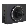
Sony A7R photogrammetric camera
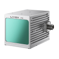
Lidar
GEO
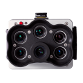
Multispectral camera
AGRO
Methane sensor CH4
GAS
Industries
Critical infrastructure
Engineering
Security
Rescue
Agriculture & forestry
Mining
Platform
Drone
Ground Control Station
Customer portal
Accessories
Company
About us
Latest news
DPA and privacy policy
Partners
Technological
Training
Distributors
Follow us
Contact
+48 797 476 054
biuro@prometheus-sa.com
Al.Krakowska 110/114
budynek B-27
02-256 Warszawa